Just a moment...
Much has been said about the history of this City. In fact, the history for the conceptualization of Harbourvale City Rapid Transit spans back to 2008! The history is taken from here.
In 2007, the government of Harbourvale City was convinced that they needed a new metro rapid system. The roads were becoming increasingly congested and citizens complained of the terrible air quality. Thus, the government saw the need of a straight line linking the northern part of the city to the CBD. As a result, the Harbourvale Line began construction and was completed in 2008. The line was a one-track system, due to space constraints and several other problems.
HCRT [Harbourvale City Rapid Transit] (then HRT) was allowed to operate the Harbourvale Line using DMUs at that time. However, due to increasing congestion, the Harbourvale Line was rebuilt in late 2008 in order to allow for construction for more houses.
In late 2008, sections of now unused tracks were abandoned and new tracks were laid to change the direction of the line. Generally, the line did not change much. Several old platforms were still utilised.
After the opening of the new small airport, a short line was needed to connect the airport to the rest of the rapid transit system. As a result, the HAEL was constructed. Train services ran from the Airport and terminated at Chinatown. It was a branch line.
In 2009, the increasing population in the southern area of Harbourvale City forced the government to extend the line from Square Quays to Blackton Junction. Many services terminated at Square Quays and turned back to serve the southern part of the line. Ridership increased too. With all these changes, as a result, a new system map was launched in 2010.
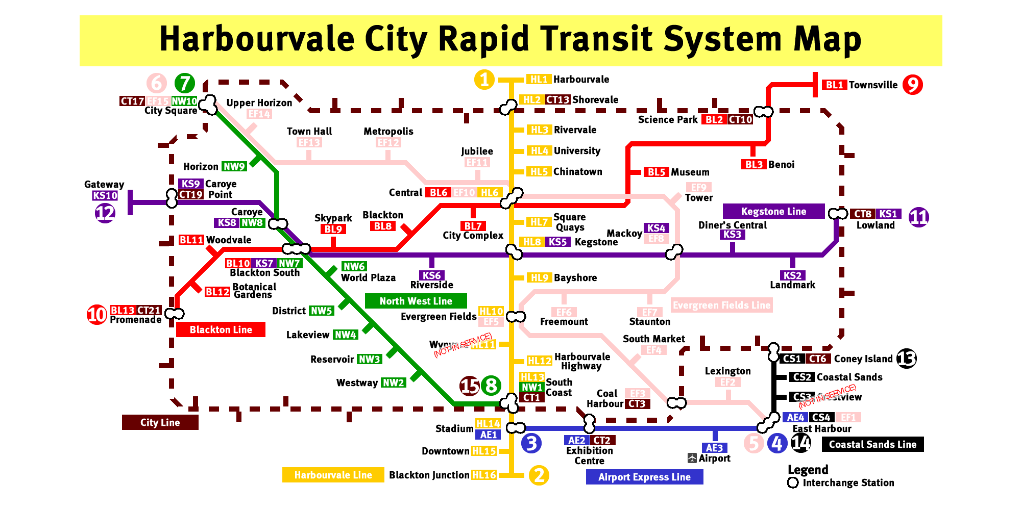
The OG system map launched in 2010
In early 2010, the government decided to tear down the whole line one last time and rebuild it again. This was to allow for construction of elevated sections to allow for more "open" stations. The government also allowed more special stations to be built. The designs of the stations were now more diverse and unique. The line began to operate fully again in May 2010. Though this line was the only line operating in HBV City, interchange details were made into the announcements to allow for other lines.
After the opening of the new small airport, a short line was needed to connect the airport to the rest of the rapid transit system. As a result, the HAEL was constructed. Train services ran from the Airport and terminated at Chinatown. It was a branch line.
As the eastern and western parts of the city grew, the government announced the Blackton Line to be built and operated by HCRT.
Although HCRT was supposed to begin operations on this line by 2008, the line was abandoned due to flaws in signalling and the land that the line was built on sank tremendously. HLRT (Harbourvale Light Rail Transport) bidded for the new line and won the bid originally, but due to financial problems (in reality, it's lack of time.), the line was given up to HCRT.
As there was a "blank spot" between City Line and Airport Express Line, the Coastal Sands Line was supposed to help passengers get from Coney Island (Yes, you heard it. It's called Coney Island) to East Harbour quicker. HMRT was awarded the line's tender.
There was not much a need to build this line, until Caroye began tremendous developement. HCRT was awarded this line's tender. Construction has started. WTC is the official contractor of the line.
This line was supposed to serve the western district of the city, allowing an alternative for passengers to transfer to the KS, BL and LR lines. HLRT was awarded the line's tender originally, but due to financial problems (refer to above for the phrase meaning), the line was given up to HCRT.
Much like the Circle Line in Singapore, this line is basically... a circle. However, due to underdevelopement in several areas of the coastal areas, this line was cancelled.
As the design of the old map began to look dated, a tender was put up to redesign the system map. TDC (Transport Design Consultancy) eventually won the tender. This also marked the first time HCRT did a reorganization of operators, and halted several lines due to rising costs. These include the City Line, and the cancelled Western Harbourvale Extension.
The LRT systems like the District LRT and Harbourvale City Light Rail (actually all LRT lines in Harbourvale) were privatized, hence they were not included in the official system map.
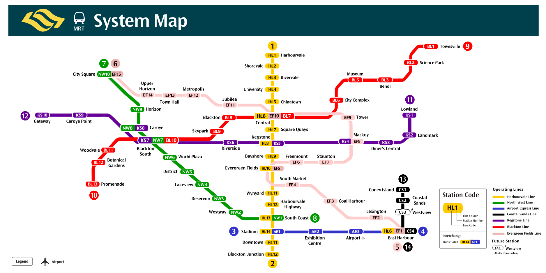
The Second System Map in use from 2017 - 2020
The first of its kind, the C100A is the very first train to be built specially for Harbourvale City. With an orange stripe running through the whole length of the train, the train will run on the Harbourvale Line. The seats are all the HCRT's livery, with orange being the front and back carriages seats' colour, red being the second and fifth carriages seats' colour and black being the two middle carriages seats' colour. 23 trainsets were purchased and is currently using ATS. These trains were decommissioned from service after the acquisition by SMRT Virtual in 2020.
In 2020, SMRT Virtual (now SMRTO) took over operations of the HCRT. The old C100As were decommissioned, replaced by our exisitng C651/A/B/C/D. Announcements were also replaced, and signages refreshed.
In tandem with Singapore's move to the new Wayfinding System, we refreshed our system map with new map and caplet designs.
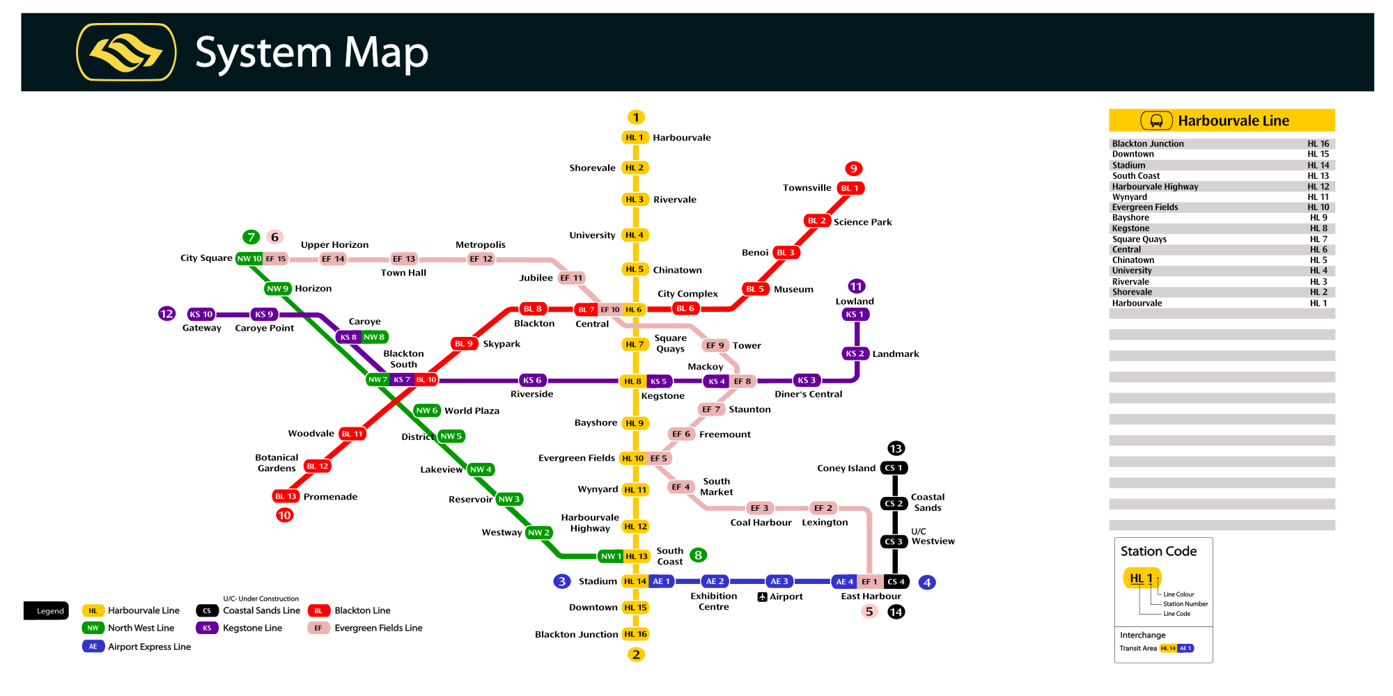
The Third System Map in use from 2020 - 2022
Several iterations of the new Wayfinding Systems were made, hence, we decided to refresh the maps yet again, in 2023 and 2024.
The Fourth System Map in use from Jan 2023 - Nov 2023 (Variant 1)
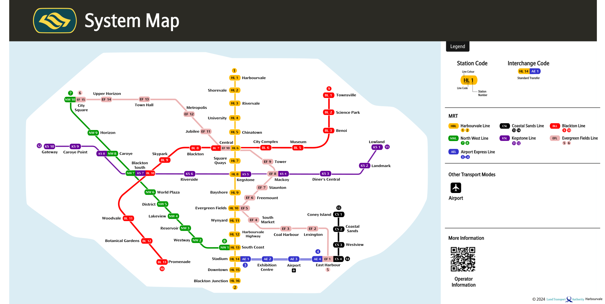
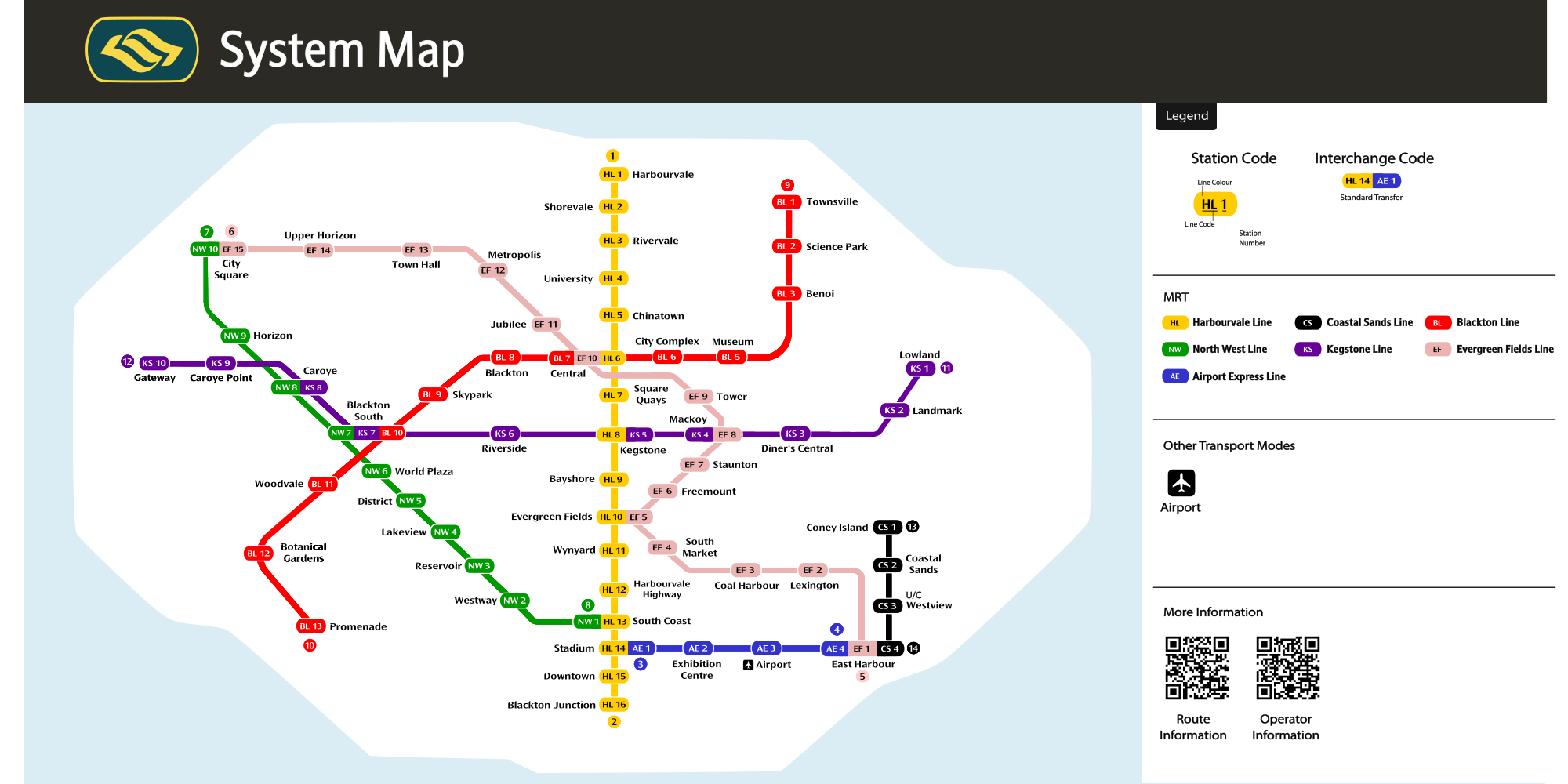
The Fourth System Map in use from Dec 2023 - Present (Variant 2)
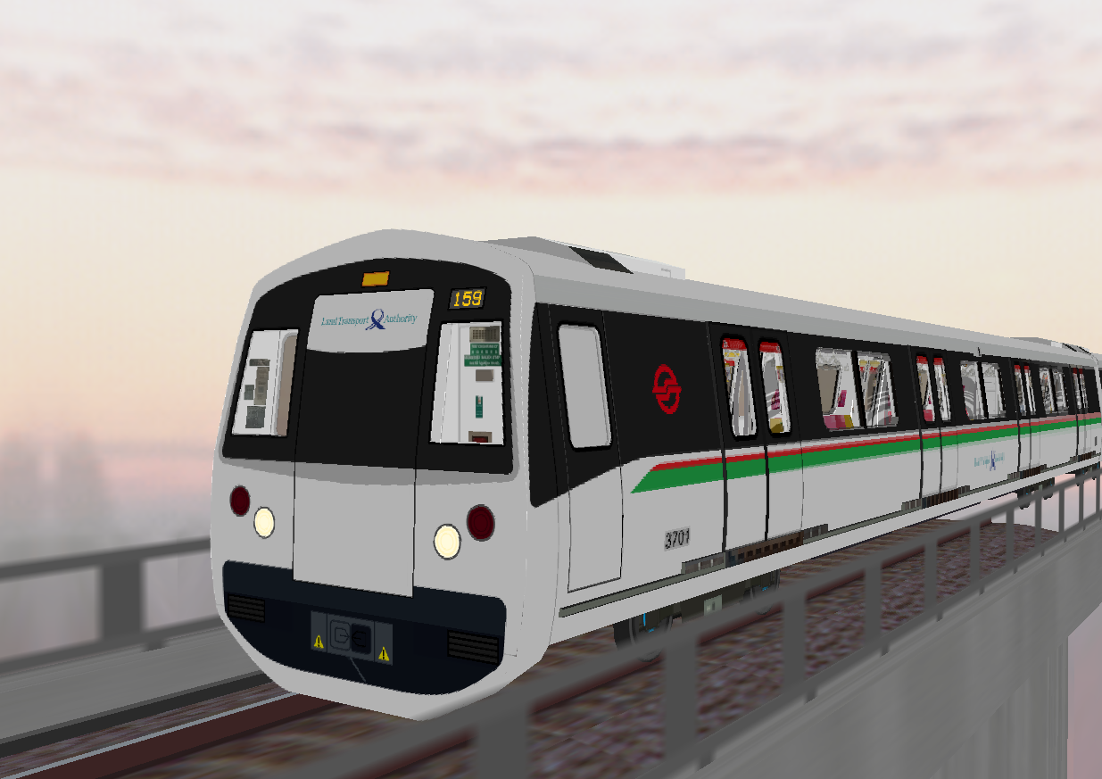
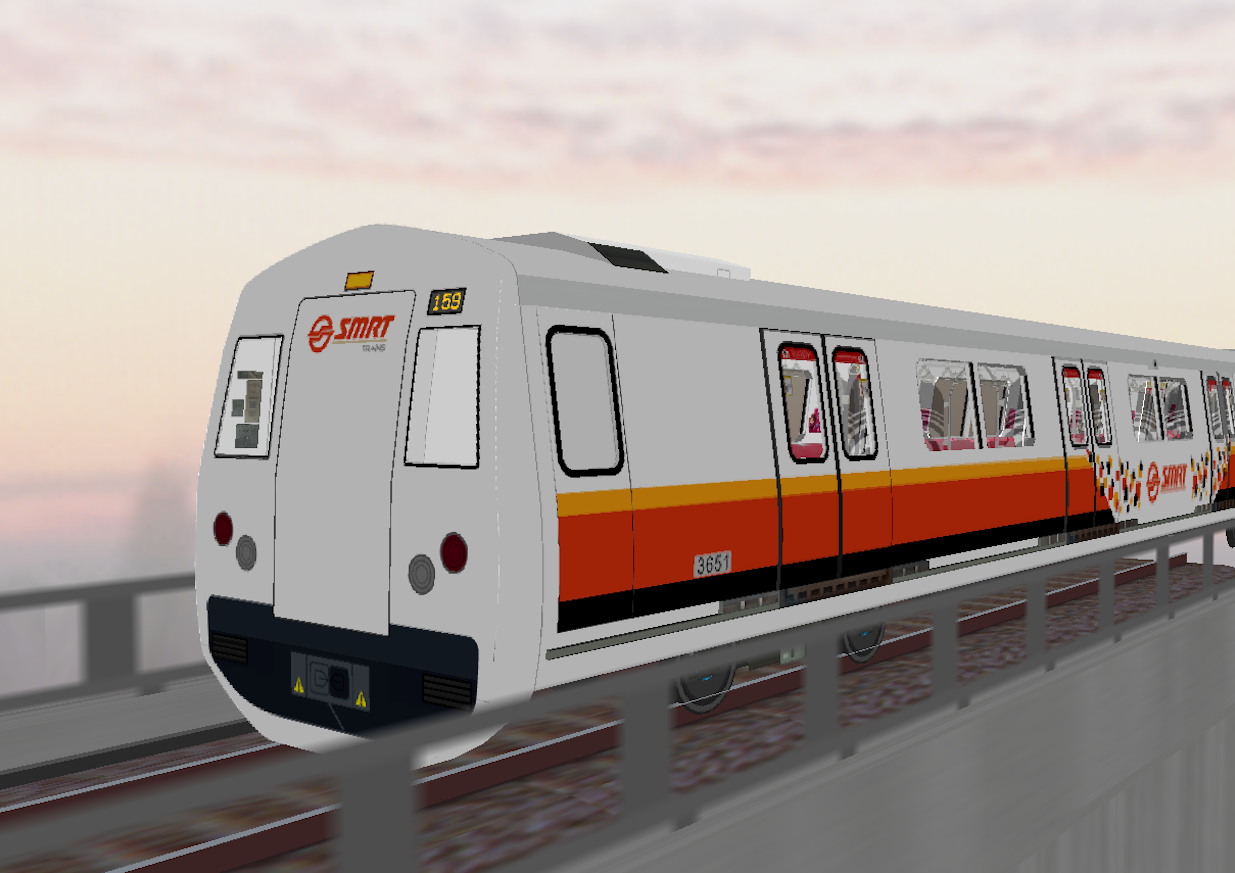
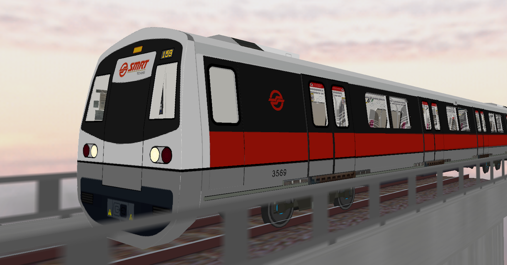
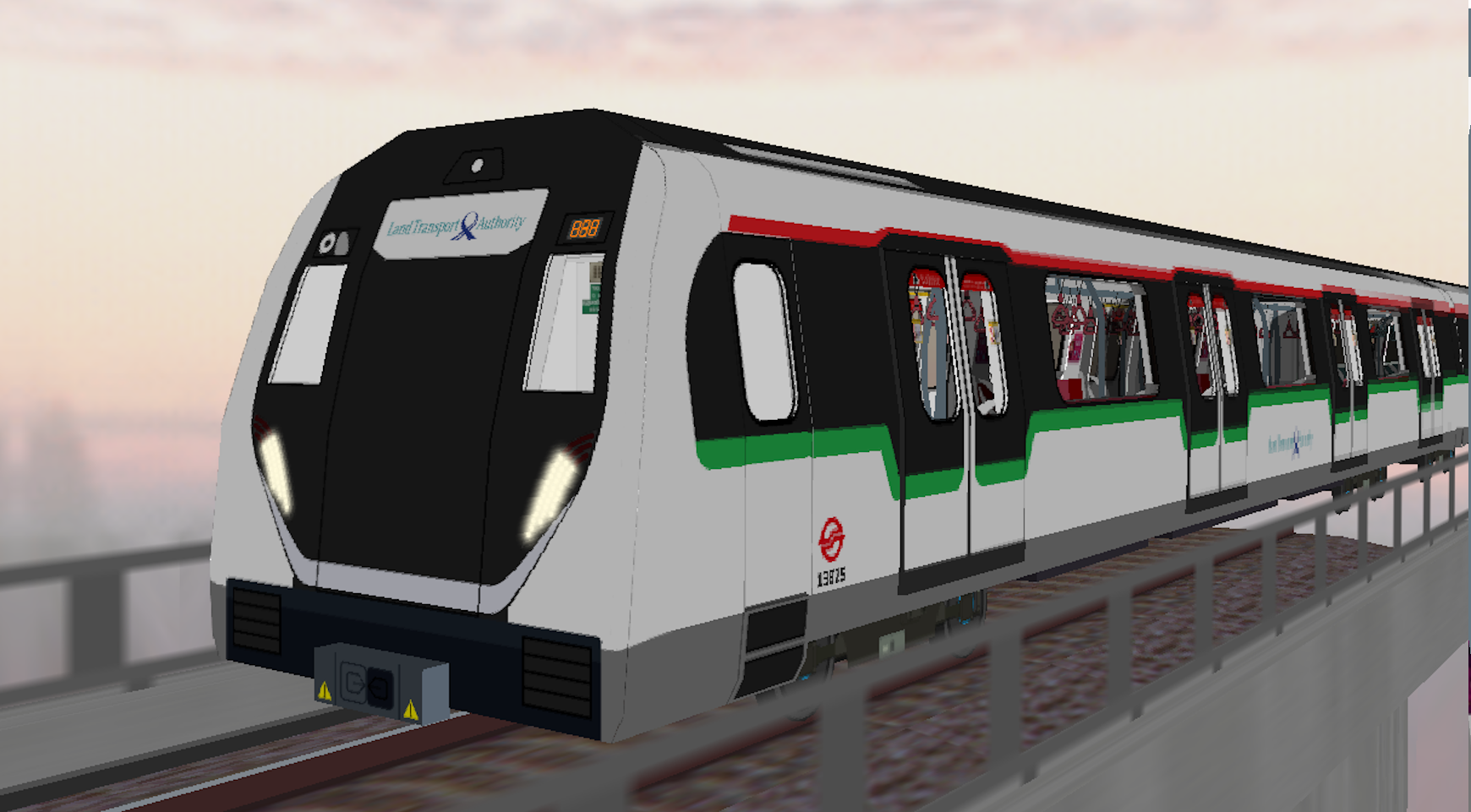
SMRTO was given the operational license extension of 9-years to operate the released maps - the HBL, NWL & AEL. As the infrastructures such as the Full-Height & Half-Height Platform Screen Doors, began to age, we decided to replace both the fleets and the PSDs. The C651/A/B/C/Ds were decommissioned and replaced by the new R151s, C151A/B/Cs. Announcements were also replaced for AEL and NWL, to standardize with HBL's announcement format.
C151C
C151B
C151A
R151